Looking at Nolli in 2015
Mapbox Studio beta is in the works and ready to be taken for a spin. I've just barely scraped the surface of what this tool is capable of, but am so far impressed with the intuitive interface and clean layering system. It's easy to start with one of the pre-made templates and transform it into something thats "yours" in just a couple of hours.
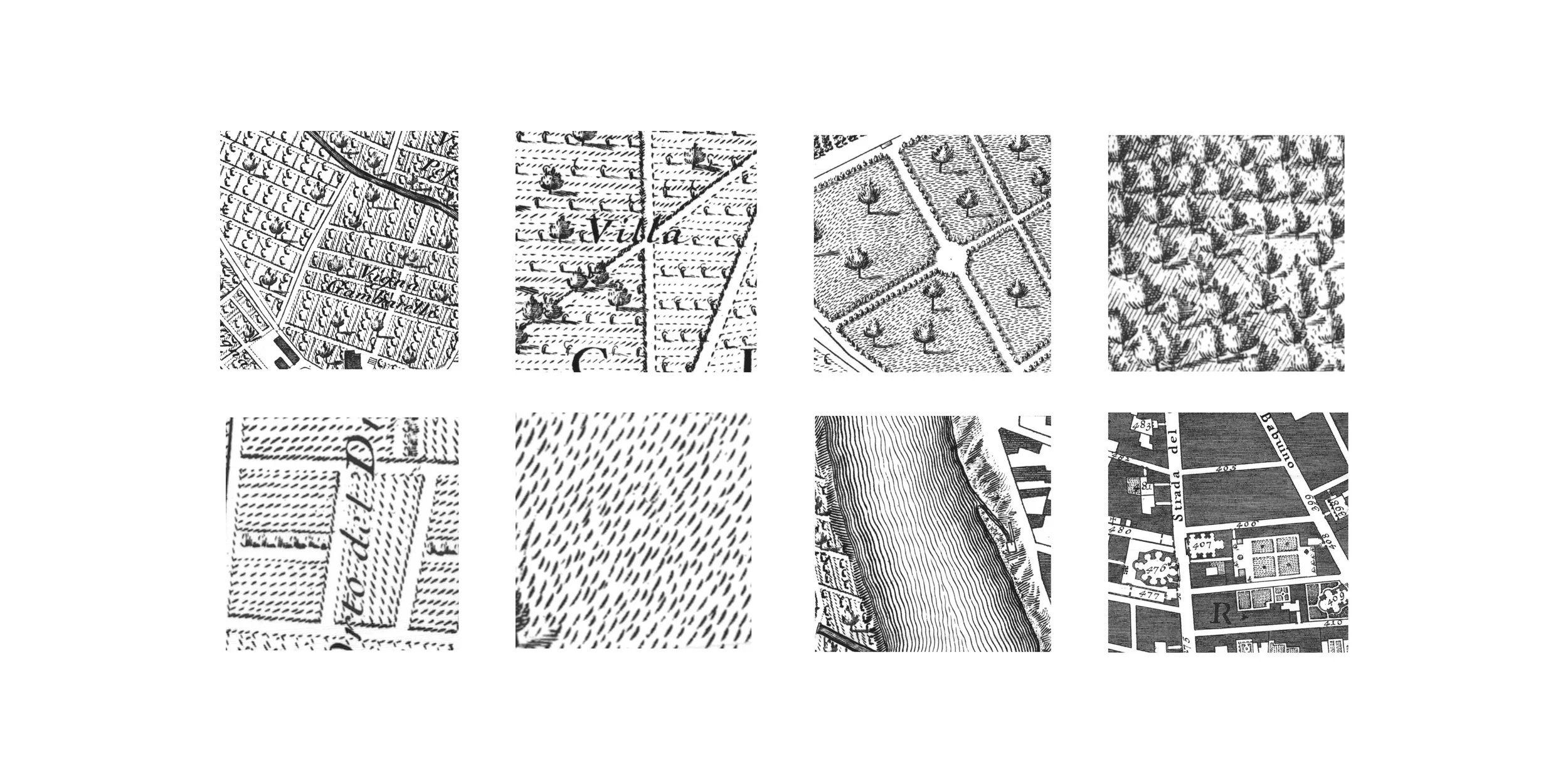
My first test drive in Mapbox Studio is a modern recreation of the Nolli map of Rome. The Nolli map took architect Giovanni Battista 12 years to survey and even more to engrave. The Nolli is famous among architects for it's figure-ground representation of urban forms-- the interiors of major civic buildings such as the Pantheon and St. Peter's Basilica are represented as void, illustrating them as public open spaces. For this exercise, I'm not clinging onto the architectural pedagogy. It would take some serious data mining to find proper plans of every civic building in the world. What I've always loved most about the Nolli plan is the illustrative distinction among land uses.
Land use designations are readily available to be downloaded and applied to Mapbox creations. Most of the template map styles already have a great selection of land uses as layers: wood, shrub, grass, parks, snow, etc. It seems like since this polygon data is global, the scale does not have great fidelity down to the finer zoom levels of city-scale, but it's a great starting point.
Mapbox uses SVG's to achieve pattern mapping onto polygonal data. This means drawing up my own illustrative land use textures in a way that can read fluidly in a square tile pattern. I like the imperfect hand-drawn aesthetic of the engravings, so I used some stock illustrator stroke styles to achieve this effect. It's hard to guess off the cuff how the scaling of the SVG will turn out, so this took a couple of tries.

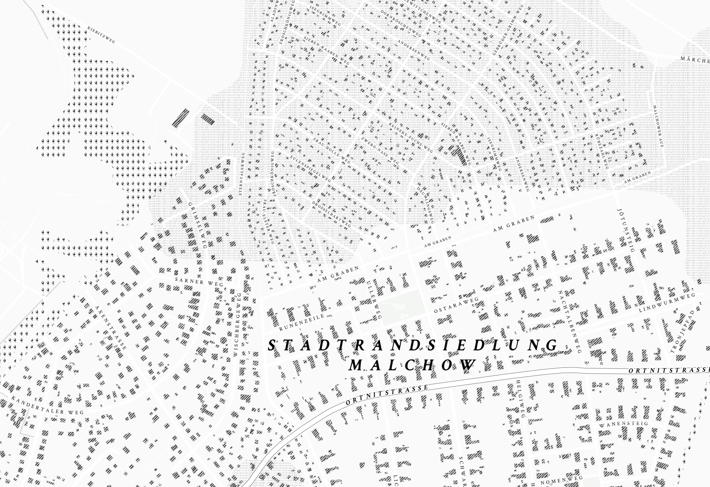
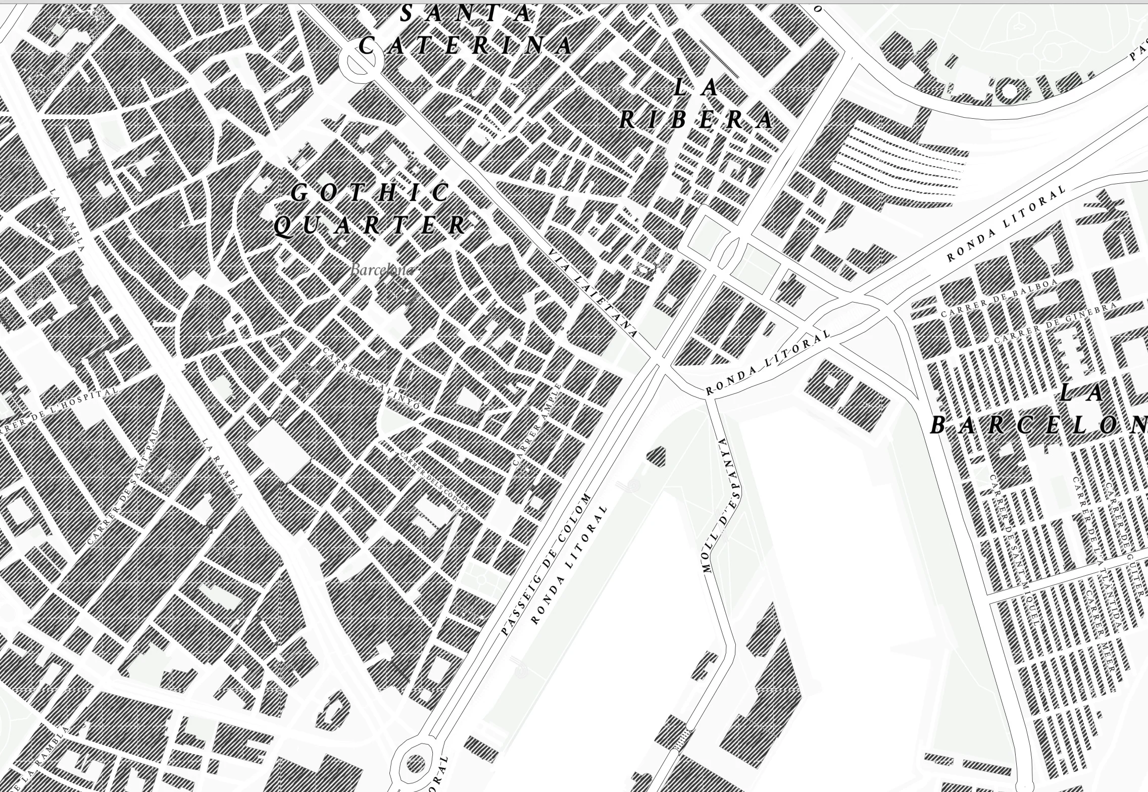
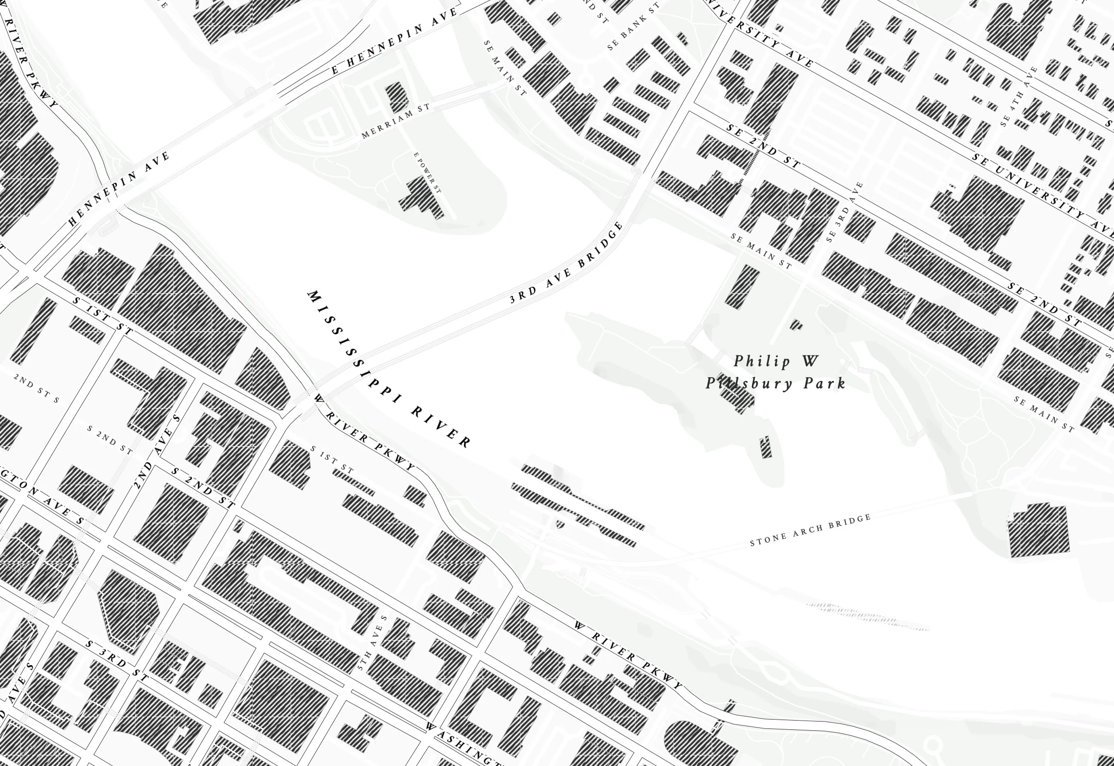
So far I've only achieved the grass, forest, and building textures. It's a challenge to get the hand-drawn quality of the lines without creating a secondary unintentional tiling pattern-- definitely something I would love to tackle in a deeper dive. The other challenge is building out patterns and overall shapes within the constraints of a square tile. These are small first steps, but you can see how the patterns are starting to tell a story about building density and land use in these different cities:


There's a long ways to go before this map is as rich and meaningful as the Nolli-- but Rome wasn't built in a day. I'll keep coming back with updates as I continue to explore this new tool.